Mendocino County Sea Level Rise Resilience Strategy
Planning for a Resilient Future on Our Coast
Mendocino County is home to 129 miles of stunning Pacific coastline, stretching from the Gualala River in the south to the Lost Coast in the north. As a coastal community, we rely on our harbors, fisheries, tourism, and natural landscapes - but these assets are increasingly at risk due to sea level rise (SLR), erosion, and climate change impacts.
To address these challenges, the County is updating its Local Coastal Program (LCP) with the latest science, policies, and community-driven strategies to adapt to sea level rise and enhance coastal resilience. In January 2024, Mendocino County was awarded $342,736 by the California Coastal Commission to do this work by creating a Sea Level Rise Resiliency Strategy (SLRRS) and completing an LCP update. This strategy is a community-driven initiative to:
- Identify risks to coastal infrastructure, communities, and ecosystems
- Plan for future flooding, erosion, and storm events
- Align with state & federal policies to ensure smart, sustainable development
- Engage the public & other interested parties in decision-making
This initiative builds on previous coastal planning efforts while integrating the latest sea level rise projections, hazard assessments, and community priorities.
Sea level rise isn’t just about science… it’s about our homes, harbors, and heritage. By planning ahead, we can adapt and thrive in a changing climate. Join us in shaping a resilient future for Mendocino County!
Together, We Can Prepare Mendocino’s Coast for Sea Level Rise!
Understanding Sea Level Rise
Mendocino County’s stunning coastline is one of our greatest treasures, but it’s also vulnerable to rising sea levels. Scientific studies predict that over the coming decades, higher tides and stronger coastal storms will impact our beaches, bluffs, harbors, and communities. That’s why we’re taking action now. It is important we ensure our coastal economy, environment, and way of life remain resilient for generations to come!
Sea levels are rising due to two key factors:
- Melting Ice Sheets & Glaciers (More water is flowing into the ocean as global temperatures rise)
- Thermal Expansion (As seawater warms, it expands, increasing ocean volume)
What does sea level rise mean for mendocino county?

Tide gauge data shows that sea levels are rising statewide. At Arena Cove, projections estimate:
- By 2050, we could see up to 1 foot of sea level rise.
- By 2100, in high-emission scenarios, we could see over 6 feet of rise. This is a worst-case scenario and would put coastal infrastructure at risk.
Other potential impacts on Our Coastline:
- Increased coastal flooding
- Erosion of bluffs and beaches
- Infrastructure damage (roads, harbors, utilities)
- Saltwater intrusion into groundwater
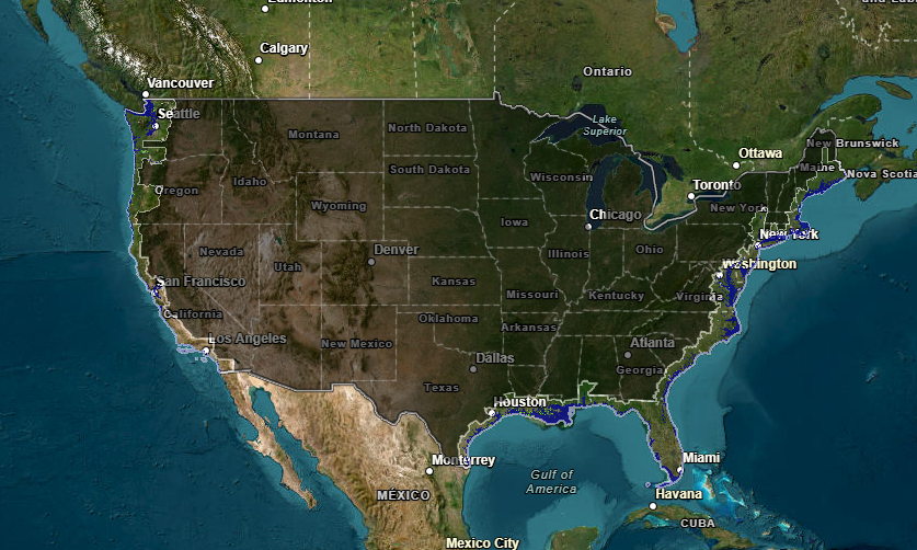
Check out this NOAA interactive sea level rise map to see how your favorite coastal areas might be affected:
What are we doing about it?

Mendocino County is taking proactive steps to address SLR and coastal resilience. Through scientific analysis, community engagement, and policy updates, the County is working to adapt infrastructure, ecosystems, and communities from the long-term impacts of rising seas. The County will be doing this through 5 tasks:
- Existing Conditions Analysis
- Reviewing hazard mitigation plans, tribal resources, and historical coastal data
- Mapping key assets using GIS technology
- Engaging interested parties to verify and refine findings
- Community Engagement & Public Outreach
- Public workshops and interested party planning sessions
- Online surveys for community input
- Social media, newsletters, and outreach materials
- Research & Risk Assessment
- Analyzing historic & projected sea level rise data
- Mapping vulnerable communities & infrastructure
- Evaluating potential adaptation strategies
- Resilience Strategy & Policy Development
- Using risk assessment findings to develop adaptation strategies to guide land use and development
- Coordinating with Fort Bragg, Point Arena, Caltrans, & other interested parties
- Aligning with statewide sea level rise planning guidance
- Final SLR Resilience Strategy & Local Policy Updates
- Updating the Local Coastal Program (LCP) to integrate sea level rise adaptation policies
- Update hazard management regulations
- Host additional public hearings before adoption
How can the community get involved?
We need your input to make this strategy work for everyone! Join the conversation:
Attend a Community Meeting
We will be hosting in-person & virtual public workshops soon. Stay tuned for dates!
Take Our Online Survey (now live!)
Share your concerns and ideas for sea level rise adaptation!
Check Back on This Webpage
We will be posting updates, maps, and interactive content.
Email Us
Have questions or suggestions? Reach out at mendocinoslrstrategy@esassoc.com
Resources and More Information
Learn more about our coastal planning efforts:
Watch and Explore
See future sea level rise on this USA Flood Map.
Project Team and Partners
- Mendocino County Planning & Building Services
- City of Fort Bragg
- Project Consultant Team
- Environmental Science Associates (ESA)
- SHN Consulting Engineers and Geologists
- ARUP
- Planwest Partners Inc.
The Project is funded by The California Coastal Commission's Local Coastal Program Grant Program.